


Why is Tucson weather trending today?
Tucson is trending because the remnants of Tropical Storm Rachel are moving into Arizona, bringing showers, gusty winds and a sharp temperature drop. Alerts such as a wind advisory and flood watch have been issued for the region.
What happened
- Oct 10, 2026, 06:00 UTC
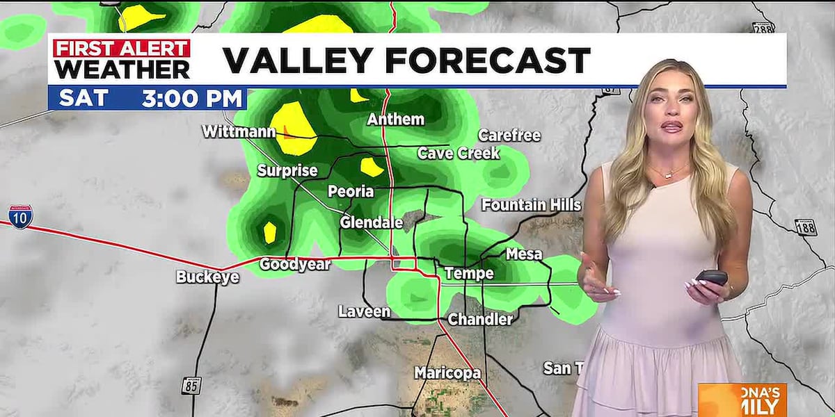
First Alert Days begin with scattered showers and thunderstorms expected across Arizona, including Tucson, and a wind advisory for most of the state [1]
- Oct 11, 2026, 08:00 UTC
A flood watch is posted for northern Arizona and a moderate risk for flash flooding is issued for western counties; wind advisory expands to nearly the entire state with gusts up to 55 mph [2]
- Oct 12, 2026, 09:00 UTC
Rainfall estimates for the Tucson area rise to a quarter‑inch to 1.5 inches, with temperatures expected to fall into the 70s by mid‑week [2]
What you need to know
Expect scattered rain showers and possible thunderstorms through Sunday‑Tuesday.
Wind gusts could reach 35‑55 mph; secure loose objects and drive cautiously.
Flash‑flooding is possible in dry washes and low‑lying areas; avoid crossing flooded roads.
High temperatures will drop from the low 90s on Saturday to the 70s by mid‑week.
Exact rainfall totals for Tucson remain uncertain, as forecasts vary with the storm’s track.
Background
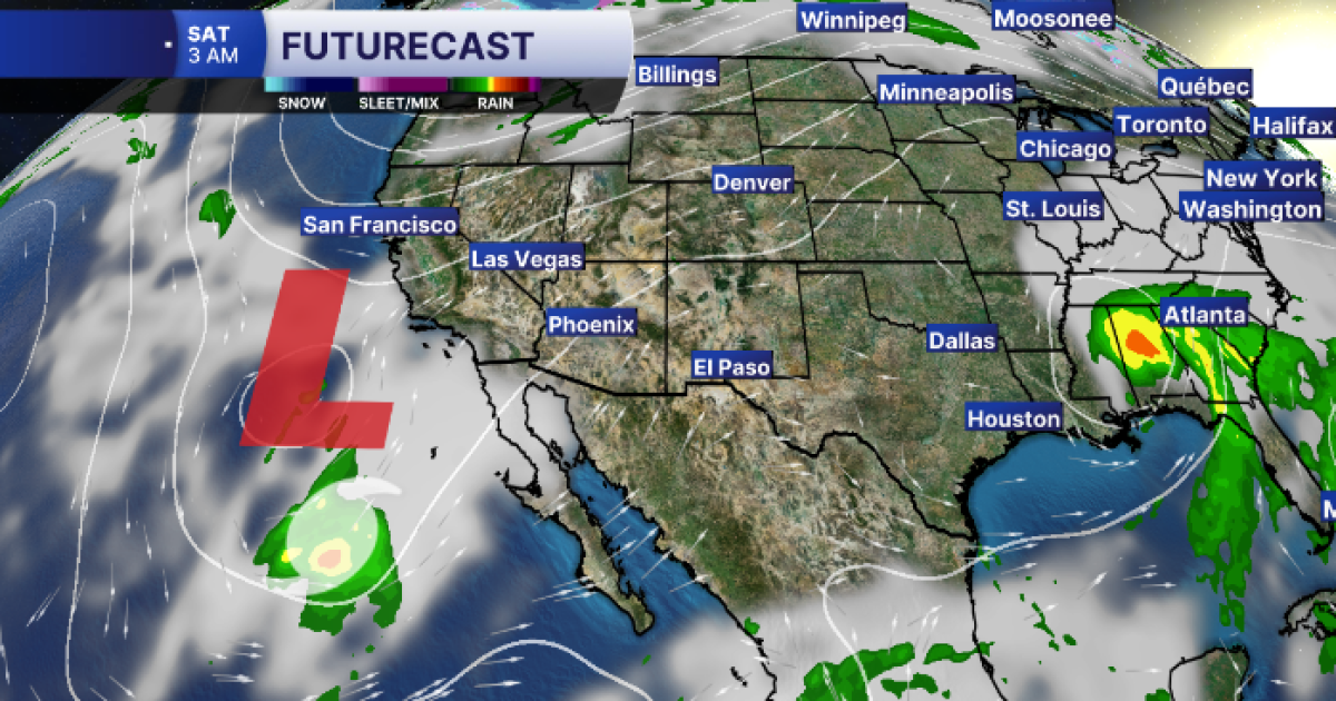
Tropical Storm Rachel is moving northward, bringing moisture into Arizona. The storm is expected to produce moderate to heavy rain, gusty winds and a notable cooling trend across the state, including Tucson.
Statewide alerts have been issued: First Alert Days for showers and thunderstorms, a wind advisory for most counties, and flood watches for areas prone to runoff. The Weather Prediction Center has assigned a moderate flash‑flood risk to western Arizona and a slight risk to the rest of the state.
Questions people ask
Will Tucson see severe thunderstorms?
A marginal risk for severe storms has been placed over central and southern Arizona, with gusty winds as the primary threat; isolated tornadoes cannot be ruled out if conditions align.
How much rain is expected in Tucson?
Current estimates range from a quarter of an inch to about 1.5 inches, with locally higher amounts possible.
When will temperatures return to normal?
Highs are expected to stay in the 70s to low 80s early next week before climbing back toward seasonal highs near 90 °F later in the week.
Where this came from
[1] azfamily.com
First Alert Days issued as storms and cooler air move into Arizona
Preview image from azfamily.com
 [2] azcentral.com
Tropical Storm Rachel is nearing Arizona. When can you expect rain?
Preview image from azcentral.com
[2] azcentral.com
Tropical Storm Rachel is nearing Arizona. When can you expect rain?
Preview image from azcentral.com
 [3] abc15.com
WHAT TO EXPECT: Big changes coming to Arizona as moisture from Tropical Storm Rachel moves in
Preview image from abc15.com
[3] abc15.com
WHAT TO EXPECT: Big changes coming to Arizona as moisture from Tropical Storm Rachel moves in
Preview image from abc15.com
Found through Google Trends and drafted with AI from at least two cited sources. Published automatically after passing our automated checks for sources, wording and safety. It may not have been reviewed by a person yet. Report a correction.